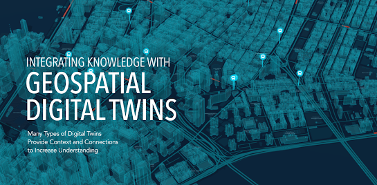
Many Types of Digital Twins Provide Context and Connections to Increase Understanding
“An open digital twin— incorporating
measurement, models, and analytics—has an opportunity to codify an open science
platform. It wouldn’t be constrained to just local geographies or the natural world, but include all of social science
and how things are related and interrelated.”
—Jack Dangermond,
Esri Founder and President
https://drive.google.com/file/d/1aUKnfrrW_F765m4JFX5f03a7zuYzC_lq/view?usp=drive_link
GEOSPATIAL DIGITAL TWINS
A geospatial digital twin is one built on a foundation of geographic information system (GIS) technology. As digital twin
technology has advanced,
geospatial digital twins have emerged as being the most comprehensive, versatile, and useful.
A geospatial digital twin aggregates the data that is found all around us. The data leaders need to make informed choices. Sensor networks and Internet of Things (IoT) devices produce a constant stream of information. Often, the only attribute these various forms of data share is location. A geospatial digital twin depicts this commonality, revealing how the various types of data exist and interact in relation to one another. Together, this data provides an intelligence edge, adding context about critical places.
It does this by displaying data using the common visual language of maps. By emphasizing the
where of data, decision-makers gain the perspective to observe the why and how.
 THE INTEGRATIVE
POWER OF MAPS
United on the Common Canvas of the Map, Connections Emerge and Relationships Are Clarified
A digital twin helps architects and engineers test scenarios during the planning
stage of a building project. Based on traffic patterns and demographic projections, how would current plans impact the area? As construction proceeds, that same digital twin is updated to display progress toward completion.
A supply chain manager sees the
company’s complex web of manufacturing and distribution tasks. The many steps
necessary—various factories of different suppliers making components that are assembled elsewhere, the logistics of moving the finished products around the world—come into focus.
A hospital uses sensor data to understand the locations of assets and patients.
This tells staff if they are facing a shortage of beds or if more personnel need to be moved to the emergency
room. Big-box retailers
do something similar,
noting where customers congregate in relation to specific offerings.
Federal
programs allocate funds to address underinvestment in disadvantaged
communities. Cities and businesses use demographic data to understand racial equity and make more equitable decisions about the delivery of services.
The ability to test future
conditions will become
increasingly important as climate
change creates more
volatility. Geospatial digital twins are now commonly used when planning infrastructure projects. They allow engineers to test the project against various future climate scenarios, with an
eye on weather extremes.
Carbon
capture and storage
initiatives require a careful accounting to contextualize activities that produce emissions or can sequester them. A geographic approach puts the focus on efficiency—and profitability—to support a greener future.
BEYOND 3D MODELING
The Many Applications of Location Intelligence
Digital twins are sometimes
described as 3D models, but that description glosses over the value of digital twins. A 3D model may be
meticulously accurate, but it is a snapshot, a frozen moment. A digital twin is
dynamic, modeling change over time.
Nearly every decision a leader makes will involve change over time: the present situation, how it has changed,
and how it is likely to evolve.
Any digital twin, by design, includes this temporal element.
This trait is what distinguishes even the simplest
digital twin from a 3D model.
Digital
twins evolve. This is what makes them such powerful
analytic tools. It is what makes them seem real.
Geospatial digital twins have now reached a level of realism that justifies the term reality capture. The geospatial digital twin aggregates high-resolution data with models from building information modeling (BIM) software and GIS data. Drone and satellite footage can help extend digital twins over entire cities or nations. Gaming engines turn these digital twins into truly immersive environments within virtual reality headsets.
The decisions you need to make for your business
demand this ultimate
command of the physical
environment. Geospatial digital
twins are not meant to imitate the world.
They are tools to help understand it.


Comments
Post a Comment