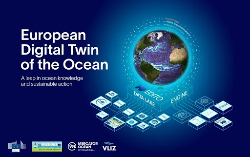
The European Digital Twin Ocean (EU DTO) is making strides

๐ŸŒŠThe European Digital Twin Ocean (EU DTO) is making strides!

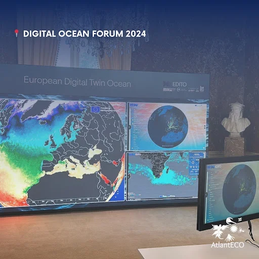
The Digital Ocean Forum 2024 on 13 June marked an important milestone for the #EUDTO, as the European Commission, Mercator Ocean International (MOi) and the @vlizostend - Flanders Marine Institute unveiled the pre-operational platform.

The event featured a live demonstration in the presence of European Commission representatives, scientific officers and civil society organisations, underscoring the collaborative nature of the project. 
A powerful tool for science-driven decision-making, the #EUDTO will represent a significant leap forward in our ability to monitor, predict, and understand Ocean dynamics, helping to drive sustainable Ocean management.
As a flagship initiative of the EC's Mission Restore Our Ocean and Waters, the EU DTO supports the EU Green Deal and the UN Decade of Ocean Science for Sustainable Development.
The platform is set to gradually scale up throughout 2025. The #DOF2024 was organised under the auspices of the @eu2024be and co-hosted by the European Commission’s Directorates-General for Research and Innovation (DG RTD), Maritime Affairs and Fisheries (DG MARE), and Defence, Industry and Space (DG DEFIS), in collaboration with Mercator Ocean International (MOi) and the Flanders Marine Institute (VLIZ).

Comments

Popular posts from this blog

Von Kรกrmรกn vortex cloud swirls from Jeju Island of Republic of Korea (South Korea)

    This Copernicus Sentinel-3 image acquired on 19 April 2021 shows several vortical cloud patterns swirling downwind south of the Spanish Canary Islands, off the coast of northwestern Africa.   These beautiful spiral clouds, known as Von Kรกrmรกn vortices, form when atmospheric circulation is disturbed by the presence of mountainous obstacles. The peculiar spiral clouds which can be seen in this image were formed as the wind airflow was deflected by the relief of the Canary Islands. These Von Kรกrmรกn vortices can be seen extending 400 km southwest due to the strong trade winds that were blowing at the time the image was acquired.   The study of atmospheric phenomena is fundamental to the understanding the fluid dynamics that underly numerous scenarios of our daily lives, from aircraft take-offs to the change in weather conditions. Open data supplied by the Copernicus Sentinel-3 mission are crucial in the advancement of scientific knowledge on cloud dynamic...

Major Storm Hits Northern California: Flash Flooding and Rockslides Threaten Region

  Major Storm Hits Northern California: Flash Flooding and Rockslides Threaten Region   SANTA ROSA, Calif. (AP) — A powerful storm swept through Northern California on Wednesday night, bringing heavy rain and snow, and posing significant threats of flash flooding and rockslides.   Key Details - Rainfall: Up to 16 inches (41 cm) of rain forecasted in Northern California and southwestern Oregon through Friday. - Snowfall: Over a foot of snow already dumped in the Cascades, with more expected in the northern Sierra Nevada. - Wind: Wind gusts could reach up to 75 mph (121 kph) in mountain areas. - Power Outages: Nearly 376,000 reports in Washington state due to strong winds and rain. - Casualties: Two fatalities in Washington state due to falling trees.   CNN news Impact on Northern California - Santa Rosa: Experienced about 5 inches (13 cm) of rain within 24 hours. - Road Closures: Southbound Interstate 5 closed for 11 miles (18 km) due to extreme weather co...

Climate change is changing hurricanes. How?

Climate change is changing hurricanes. How?  #EarthScience #NASA #Hurricanes #ClimateChange  Image Descriptions 1: An image of Hurricane Idalia from space taken by an astronaut aboard the ISS is positioned in the bottom half of the image. White text reads “Climate change is affecting Hurricanes.” with “hurricanes” in blue lettering on a black background at the top.  2: An image divided into four panels by blue lines. The left most panel runs top to bottom showing a piece of the image from the previous slide while the other three panels divide the right side of the image. The top is white text on a black background and reads “How do hurricanes form?”. The middle shows an image of an eye of a hurricane from space. The bottom panel reads “4 main ingredients:” in blue text and lists “Warm ocean waters near the surface, High humidity in the air, Favorable winds, and A pre-existing disturbance (like a cluster of thunderstorms”  3: An image with white text on a black backgr...