New software enables AI-powered bathymetric data processing
New software enables AI-powered bathymetric data processing
Hydroacoustic technology specialist GeoAcoustics has officially released GS4 software v1.0.25 for GeoSwath bathymetric sonars, adding several upgrades including an artificial intelligence data processing system developed in collaboration with the University of East Anglia.
The new AI processing augments the existing automated filtering in the GS4 software by removing surplus and undesired data autonomously; during acquisition, the system is designed to log clean data, without any user intervention in the cleaning process, enabling better operational agility and decision support while cutting the time to final data in post-processing.
Real-time processing
The processing happens in real time, so users only need to oversee data quality and coverage during acquisition, while at the post-processing stage the focus can be purely on georeferencing the bathymetric data using deterministic calculations. The final, noise free and high-resolution bathy products will be fully reproducible with minimal human intervention.
“Our new AI provides real-time actionable bathymetric data on the survey vessel, providing scope for checking coverage and target detection while out on the water,” said Richard Dowdeswell, general manager, GeoAcoustics. “It negates the need for a return survey as the quality of the data acquired is known before returning to shore, which reduces the potential for cost overruns and accelerates delivery of the final data to the client.”
GS4 software v1.0.25 adds further operational improvements including survey accuracy indication and an auto mode for sidescan data processing.
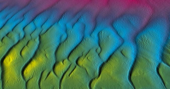
<Lowestoft Stanford Channel sandwaves 3D bathymetric imagery. (Image courtesy: GeoAcoustics)>
https://www.hydro-international.com/content/news/new-software-enables-ai-powered-bathymetric-data-processing


Comments
Post a Comment